Nullaki Wildlife Conservation Area landholders have been undertaking a feral control program for many years. The Wilson Inlet Catchment Council (WICC) is working with the Nullaki landholders to establish an ongoing, sustainable fauna monitoring (native and feral) program to gauge the effectiveness of feral control efforts.
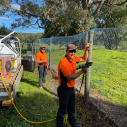
The Nullaki Peninsula near Denmark was once a pastoral area. In the late 1990’s the western end of the peninsula (2,400 ha) was rezoned as “private property; conservation zone” and a vermin proof fence and gate was installed to minimise feral predator entry. The bulk of the property was subdivided into approximately 30-50 ha blocks which were sold to private parties. Since then a number of the landholders have been actively involved in a feral control program and have formed the Nullaki Conservation Initiative which is a sub-committee of the WICC.
Approximately 85-90% of the Nullaki Wildlife Conservation area is maintained as remnant vegetation and consists of a variety of vegetation communities including mallee heath, karri, temperate coastal saltmarsh, peppermints and grasslands. The Nullaki Conservation Initiative’s main focus is to exclude feral animals and enhance the biodiversity of this relatively intact bushland though ongoing management efforts.
Nullaki feral control has involved 1080 baiting, calicivirus rabbit control and cat trapping. Much time, patience, research, trialing and sharing has been invested in developing the most effective feral control methodologies for the peninsula.
A fauna survey was conducted in late 2018 to establish baseline data to better understand the resident faunal communities and establish a means of gauging the effectiveness of feral control efforts (baiting, trapping, fence upgrades, etc.). A second survey was undertaken in April 2019 and the results of both surveys can be found here.
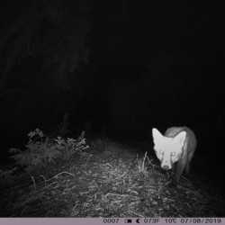
The current monitoring plan, which has been reviewed and supported by the Department of Biodiversity Conservation and Attractions and South Coast Natural Resource Management, is using camera traps and spotlighting surveys to:
- Determine absence/presence of fox and cats and trends in the frequency of sightings.
- Identify presence / absence of Western Ringtail Possums.
- Identify native species presence.
- Inform feral management controls/efforts by identifying any variations on fauna (native and feral) in baited vs unbaited areas.
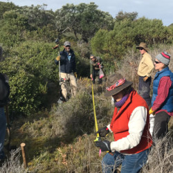
The project involves The Moorditj Noongar and Yorgas — Albany Aboriginal Rangers in setting up camera traps and analysing the data as well as Nullaki landholders and other community volunteers.
This is a Wilson Inlet Catchment Committee project.
This ongoing work has been or is funded by South Coast NRM, National Landcare Program and the State Natural Resource Management Organisation.


